


Do you want to know the history and tips about the municipalities crossed by the Challenge Sanremo 2025? Here is all the information you need (VIDEO).
Find out when you will cross the locations during the race: study the courses of the sprint distance and middle distance races! (VIDEO)
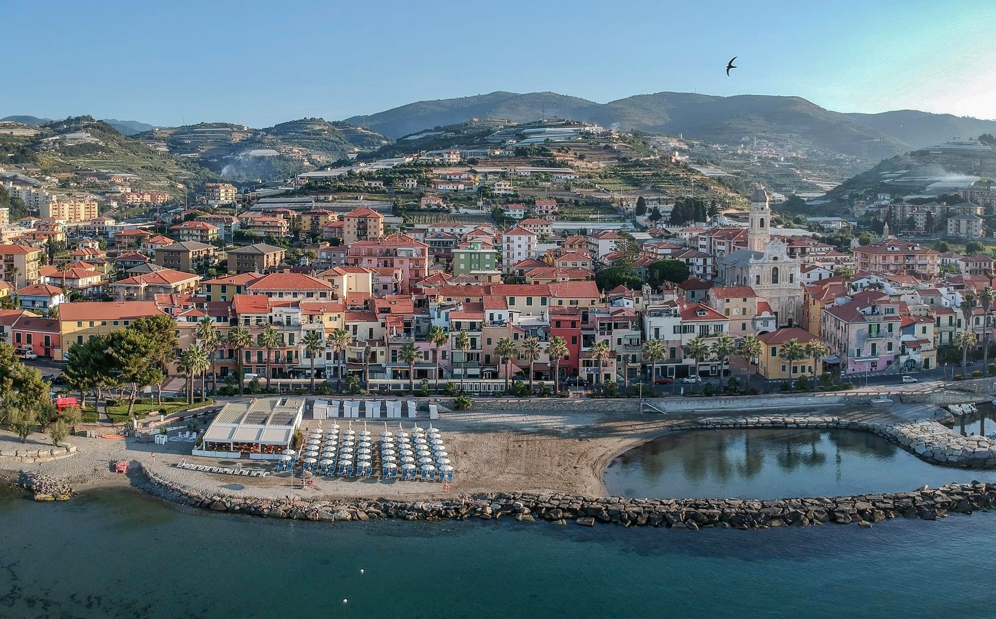
SANREMO
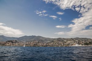
The most populous town in the province of Imperia (about 54,000 inhabitants) is located along the Riviera dei Fiori. Famous tourist resort, renowned for the cultivation of flowers, hence the nickname of “Citta dei Fiori” (City of Flowers), hosts the arrival of the Milan-Sanremo cycling race (one of the classic monuments of world cycling), the Italian Song Festival, the Prize Tenco, the rally motor racing and, for two decades, international triathlon events. It is also the home of one of the four casinos in Italy.
The origins. Its ancient name, Villa Matuciana, apparently derives from a Roman deity, Mater Matuta, goddess of the dawn, who gave beauty to this stretch of Ligurian coast by overturning the contents of its cornucopia. Located in a large inlet between Cape Verde or Punta d’Arma and Capo Nero, Sanremo is considered the “pearl” of the Riviera dei Fiori and has the reputation of being one of the most famous climatic-seaside resorts in Italy and in the world. accompanied by fantastic hotels. Protected from the north winds by the surrounding hills that stretch out like an amphitheater behind it, it could become, as well as one of the capitals of tourism, an important center for floriculture. Loved by foreigners since the last century, a meeting place for the beautiful world, Sanremo is also its Casino, an Art Nouveau building (1906), a symbol of the Belle Époque, known not only for its gambling halls, but for its theater and Salone delle Feste, where concerts, conferences, literary meetings, magazine shows, gala evenings and other artistic and social events take place. By now the whole world knows the Ariston, where the Italian Song Festival takes place, which with its whirlwind of singers, presenters, cinema and theater stars and journalists glues the beautiful country in front of the TV. And what about one of the historical events of sport, the Milan-Sanremo cycling race, which sees a nice stretch of our Liguria flow under the wheels of the champions? Since the past centuries, Sanremo has been a destination for prestigious foreign tourists who have chosen the city as their new residence: Tsarina Maria Alexandrovna arrived in Sanremo in 1874 by train, having inaugurated the Genoa-Ventimiglia line a year earlier, like the scientist Alfred Nobel . In 1860 Pietro Bogge di Rivoli had opened the first large hotel, the Grand Hotel Londra, while in 1871 the Gran Hotel Royal had been inaugurated. In 1878 the guest list gave Sanremo 167 English, 171 Germans and a smaller number of subjects from other countries. In 1901 there were 21410 tourists with an average daily stay in the winter high season of 4153 people. Sanremo then had 22,440 inhabitants and in the last 20 years 25 new hotels had been opened and about 200 private villas built.
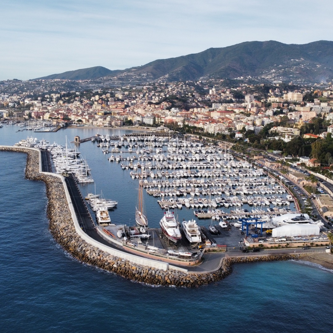
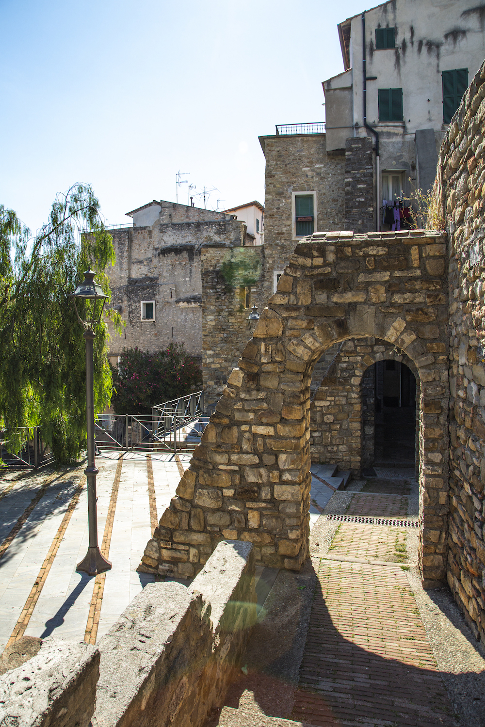
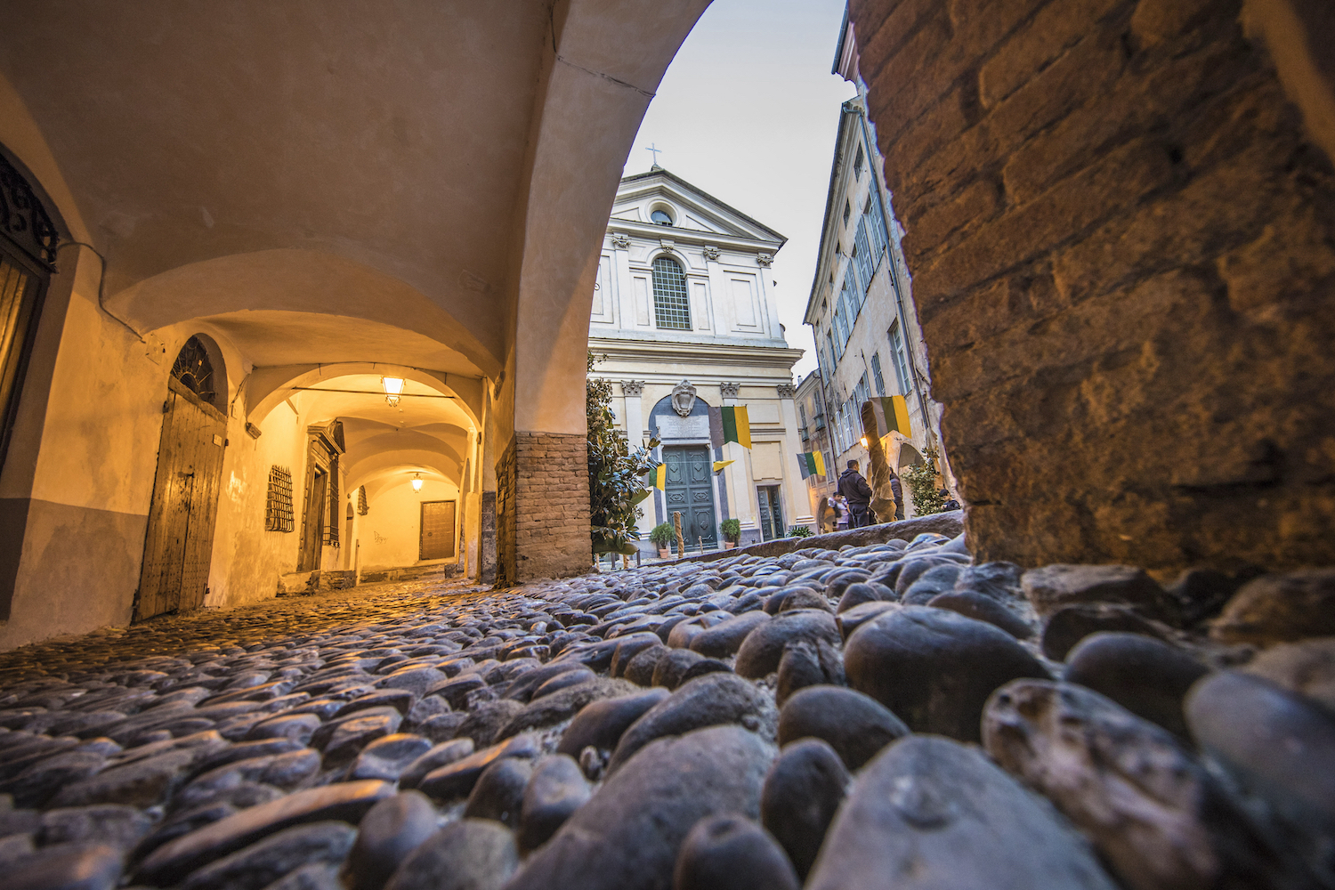
The new Sanremo. The modern Sanremo extends over the plain, along the coast; the old city, the Pigna, is grouped in the interior. From Corso Matteotti, near the railway station, which overlooks the Casino, you enter Corso Imperatrice, dedicated to the Tsarina Maria Alexandrovna who gave her palm trees in 1885 and flanked by the Marsaglia Park (with an auditorium for concerts and shows at the ‘open). Next to it stands the Russian Orthodox church of San Basilio, a small model of the Moscow churches with onion domes built at the end of the 19th century. From there the Corso degli Inglesi winds its way through the green, climbing the hill from which you can enjoy the panorama of the city. On Corso Matteotti overlooks the Palazzo Borea d’Olmo (from the 16th-17th centuries) which houses the Civic Archaeological Museum, which includes a prehistoric section with finds from the Paleolithic, Neolithic, Bronze and Iron Ages and Roman finds. of local villas and necropolis, and a picture gallery, as well as a collection of Garibaldi relics. In Corso Garibaldi there is the seventeenth-century church of Santa Maria degli Angeli and, behind it, the square of the flower market. Along Corso Cavallotti there are the Gardens of the Villa Comunale. Corso Trento e Trieste represents the seaside promenade that reaches the harbor inlet. At the beginning of the pier stands the fort of Santa Tecla, built in 1755 by the Genoese. Not far from the square dedicated to the Heroes of San Remo (Piazza Eroi Sanremesi) stands the Cathedral of San Siro, a Roman-Gothic building from the 13th century on the remains of an early Christian parish church and a proto-Romanesque church; the adjacent baptistery, modified in 1668, is based on Roman and early medieval remains, the rectory is a 12th century Romanesque building. Inside, on the main altar, a large wooden crucifix by Maragliano. On the back wall of the choir, the SS. Siro, Pietro, Paolo, G.Battista and Romolo in a panel (1548) by Pancalino. In front of the cathedral there is the sixteenth-century Oratory of the Immaculate Conception which houses eight paintings depicting episodes from the life of the Madonna. From there you go up to the oldest heart of Sanremo, the Pigna. Through the Porta di Santo Stefano, formed by a Gothic arch of 1321, you enter a maze of alleys, stairways, houses with arches and pointed windows, stone columns and carved architraves, covered alleys or crossed by counterthrust arches. Beyond Piazza Castello stands the sanctuary of the Madonna della Costa (16th century). On the eastern end of the city extends the park of Villa Ormond and, towards the sea, Villa Nobel with its gardens, home to cultural events and an exhibition on the activity of the Swedish scientist who died in Sanremo in 1896. In search of more ancient monuments, at the Foce (2 kilometers from the center) there is the Roman villa of the same name, divided into nine rooms and including a small spa complex. In the aforementioned Civic Museum it is possible to appreciate the finds collected in the Grotto of the Madonna dell’Arma in Bussana. A short distance from Piazza Colombo in Sanremo, along the escarpment that descends from the Pigna hill, at the last bend of the underlying San Francesco stream, in 1960 an emergency intervention was carried out to preserve an important prehistoric site. The finds from this site are also in the Civic Museum.
Outside Sanremo. Behind Sanremo, as mentioned, the Bignone peak (with the remains of the ancient pre-Roman fortification) rises, touching 1300 meters, and at an altitude of 786 meters along the homonymous stream, is the village of San Romolo. The nearest valley to visit is the Armea Valley which is located east of the city. From the Poggio di Sanremo you go up to Bussana Vecchia, which has become famous as the “artists’ village” and is full of artisan shops. It was once surrounded by walls and the urban layout is annular, developed around the baroque church, on whose walls spared from the earthquake of 1887 you can still see some frescoes; the bell tower is almost intact.
Agriculture. Since the twelfth century there is news of the cultivation of citrus fruits (first the cedars and then, brought by the Crusaders, lemons, bitter oranges and sweet oranges). There is ample documentation on the long history of these crops and of the fruit trade in the municipal statutes. The Municipality of Sanremo regulated the collection, production and sale with an uninterrupted series of measures, allowing producers to form a consortium (1843) that will remain alive until 1930, issuing numerous regulations and decrees that met the needs of the most important citrus wholesale market in northern Italy. Already at the beginning of the last century the fruits were divided and rigorously selected for size and quality. Sanremo is characterized by palm trees: tradition has it that the first seeds were brought by either Sant’ Ampelio anacoreta who came from Thebaid in 411 or the Crusaders returning from the Holy Land (1096). Already in the fifteenth century the cultivation of the date palm was already widespread in the Sanremo area and its leaves were sold for Roman and Jewish religious ceremonies (processed differently depending on the destination). A maritime captain from Sanremo, Benedetto Brasca (died in 1603), obtained the privilege of supplying the palms to the Holy See and the privilege has passed from heir to heir up to the present day. The olive trees complete the agricultural landscape and the image of the Sanremo of other times. The trees of Sanremo were strong and centuries-old specimens that survived the great frost of 1709. In the mid-19th century there was the first olive growing crisis, a crisis which in the first decades of the 20th century worsened in coincidence with the conversion to floriculture and tourism. The history of floriculture in Sanremo and throughout the province has a starting date: 1856, when the Parisian writer Alphonse Karr, who, in exile, had found refuge in the still Italian Nice in 1951, started his business of flowers by train, sending baskets of violets, daffodils and buttercups to Paris. In 1868 a perfume shop was opened on the current Corso Matteotti: it was managed by GioBatta Aicardi, the distiller and creator of the famous “essence of San Remo violet”. The first real company for exporting cut flowers (Bessi-Julien) dates back to 1874 and by 1880 it was already shipping about a hundred baskets of roses a day. Meanwhile, the Lyon gardener Guillard introduced the carnation and its reproduction by cutting to Nice and Lodovico Winter, creator of the Hanbury Garden, founded his first establishment. Starting from 1910, floriculture was practiced on a scientific basis with the establishment of the Experimental Station of Floriculture headed by Professor Mario Calvino. The Flower Market had a permanent seat in Sanremo from 1914.
Institutional site: https://www.comunedisanremo.it
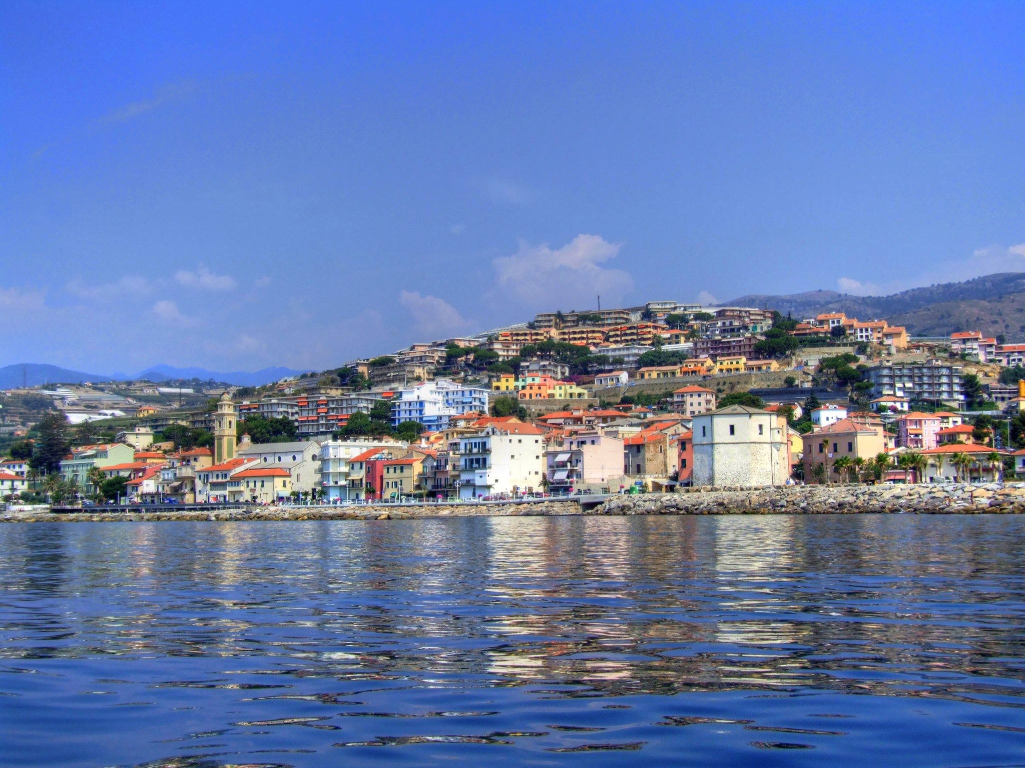
TAGGIA
Taggia is located just six kilometers from Sanremo and about twenty from Imperia, roughly in the center of the Riviera dei Fiori, boasts the mild climate typical of this corner of Liguria, a vast and sandy beach and hotel facilities for all tastes and all pockets. Arma di Taggia, the seaside village, owes its name to the cave inhabited in prehistoric times, which was transformed into a chapel containing the altar of the Madonna dell’Arma. The cave opens towards the rock of the Annunciata, near a quadrangular tower of sighting and defense of the sixteenth century. Behind the bay of Arma di Taggia, the Argentina Valley rises, crossed by the stream of the same name. From Arma you go up, along state road 548 for three kilometers, to Taggia, one of the oldest and most illustrious centers of the Riviera di Ponente. Rich in history and popular traditions, Taggia has a characteristic medieval structure, with towers and walls, and boasts numerous works of art preserved in its churches. Entirely built vertically, with steep stairways and abrupt changes in level that create suggestive glimpses, it has three types of walls, and its heart is reached by crossing the Porta dell’Orso. This locality gives its name to the most famous variety of Ligurian olive, the “taggiasca”, as tradition has it that the Benedictine monks introduced the cultivation of the olive here in the distant 12th century. Going up along the path of the streams starting from the coastal towns is perhaps the best way to proceed to discover the Ligurian hinterland.
Institutional website: https://comune.taggia.im.it
RIVA LIGURE
Riva Ligure, a seaside village of 2,800 inhabitants with the houses of the historic core built almost on the beach, is part of the so-called fief of Villaregia, which includes the territory of the eastern Argentina Valley, that of the San Lorenzo Valley and arrives, to the north, to Monte Faudo (1149 m). The Santa Caterina stream separates Riva from Santo Stefano al Mare; the locality extends over a coast of just over two kilometers and the new part was built towards the interior and therefore Pompeiana. The city core, as is typical of the Ponentini villages, is arranged around a long and narrow road axis parallel to the beach. The promenade is full of palm trees, also present in the beaches. To admire Borgo Torre and Piazza Ughetto, with the sixteenth-century tower. The Town Hall (former palace of the Marquises Carrega), the oratory of San Giovanni Battista and the Parish of San Maurizio (with the characteristic parvis of sea pebbles) are located along via Nino Bixio. San Maurizio has a single nave and eight chapels. The remains of the Benedictine convent of the Grange are visible north of the Aurelia at the foot of the homonymous mountain. The church, which, over time, was incorporated into the town, is today the Sanctuary of the Madonna del Buon Consiglio. It may have already existed since 1049, but the nave, the apse and the external buttresses date back to the fifteenth century. On the outer wall on the right there is the tomb of the poet resold Francesco Pastonchi, also mentioned in an inscription on the town hall. This town has been awarded the Blue Flag, testifying to the quality of its sea. (VIDEO)
Institutional website: http://www.comunedirivaligure.it
SANTO STEFANO AL MARE
Arriving in Santo Stefano al Mare, by car or train, the first impression you get is that of immersing yourself in a sea of flowers, as the communication routes pass through the flower crops. In fact, of the approximately 2200 inhabitants of this municipality, many are engaged in the agricultural sector, which, together with the tertiary sector and tourism, constitutes the backbone of the local economy. Santo Stefano al Mare is separated from Riva Ligure only by the Santa Caterina stream. In Marina degli Aregai, a well-equipped tourist port (completed in 1992), which is located just over half a kilometer from Santo Stefano towards the border with Cipressa, pleasure boating enthusiasts can find a comfortable welcome. The widest beach is that of the Torre, while along the other stretch of coast the beaches become increasingly narrow; for bathers, however, there are artificial reefs (created to defend the coast from storm surges) and a shallow sandy bottom suitable for less experienced swimmers or those who like to enjoy a little relaxation.
Institutional website: http://www.comune.santostefanoalmare.im.it
TERZORIO

The first houses of Terzorio were built along the sublitorial road that connected the centers of the immediate Imperia hinterland: in fact, from the Late Antiquity period, we witnessed the progressive abandonment of the Via Julia Augusta, which ran too close to the coast and which for this reason it was not safe enough, in favor of itineraries that wound through the countryside. The mild climate of the area and its favorable position for crops have meant that, in times closer to us, Terzorio has experienced considerable economic development, especially in the direction of floriculture and greenhouse cultivation, which has resulted in an urban expansion that fortunately, it did not compromise the conservation of the original nucleus of the village.
Institutional website: http://www.comune.terzorio.im.it
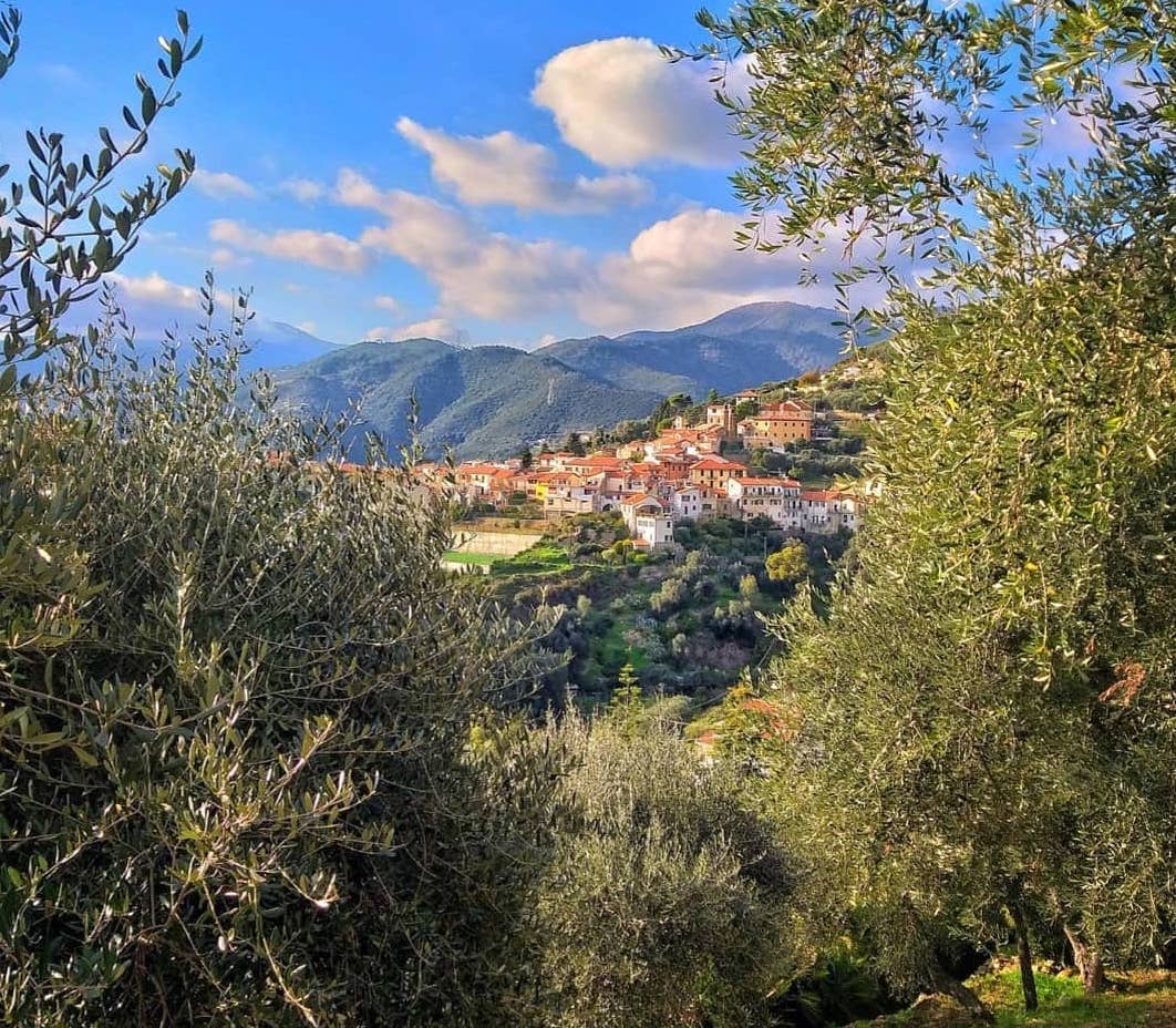
POMPEIANA

The village of Pompeiana stands on the Roman rustic villa of the fundus Pompeianum, hence the name of the locality, connected to the mansio of Costa Balenae, the stopping station for goods which was located on the coastal road via Julia Augusta and connected to the nearby road for the Gaul. The upper part of the town, equipped with fortifications of which important architectural testimonies remain. In the lower part of Pompeiana there is an example of a military structure in the Panei tower, in Costa Panera, a bastion built in the sixteenth century to spot the enemy and which now houses a museum. In the heart of the town, on an open space that opens up panoramic on the sea and on the Panei tower, stands the parish church of Santa Maria Assunta flanked by the high bell tower erected in 1726. In the area adjacent to San Bernardo, there is an area of particular naturalistic value, in which live the very rare “Ocellated Lizard” and the dotted Pelodite (another very rare animal in Italy) as well as the spontaneous presence of some precious species of Mediterranean orchid.
Institutional website: http://www.comunedipompeiana.net
CASTELLARO
The origin of the name of the locality of Castellaro, in all likelihood, refers to a fortified settlement of the pre-Roman era, the existence of which is evidenced by the finds found on the nearby Grange hill. The inhabited area has the houses arranged one next to the other, on the sides of the road, forming two curtains that open into arches and open spaces on which the secondary lanes converge. Of the castle that stood in the heart of the village, in a raised position, there remains only a semicircular tower equipped with machicolations. In the Baroque period, the parish church of San Pietro in Vincoli and the oratory of the Assumption were built on the raised open space that the demolition of the castle had left free. The Sanctuary of Nostra Signora di Lampedusa is located in a beautiful panoramic position over the lower Argentina valley and the hills of the Riviera covered with olive groves. In the summer, the stairways and walls surrounding the building are decorated with cascades of colorful geraniums of great effect. (VIDEO)
Institutional website: http://www.comunedicastellaro.it
BADALUCCO
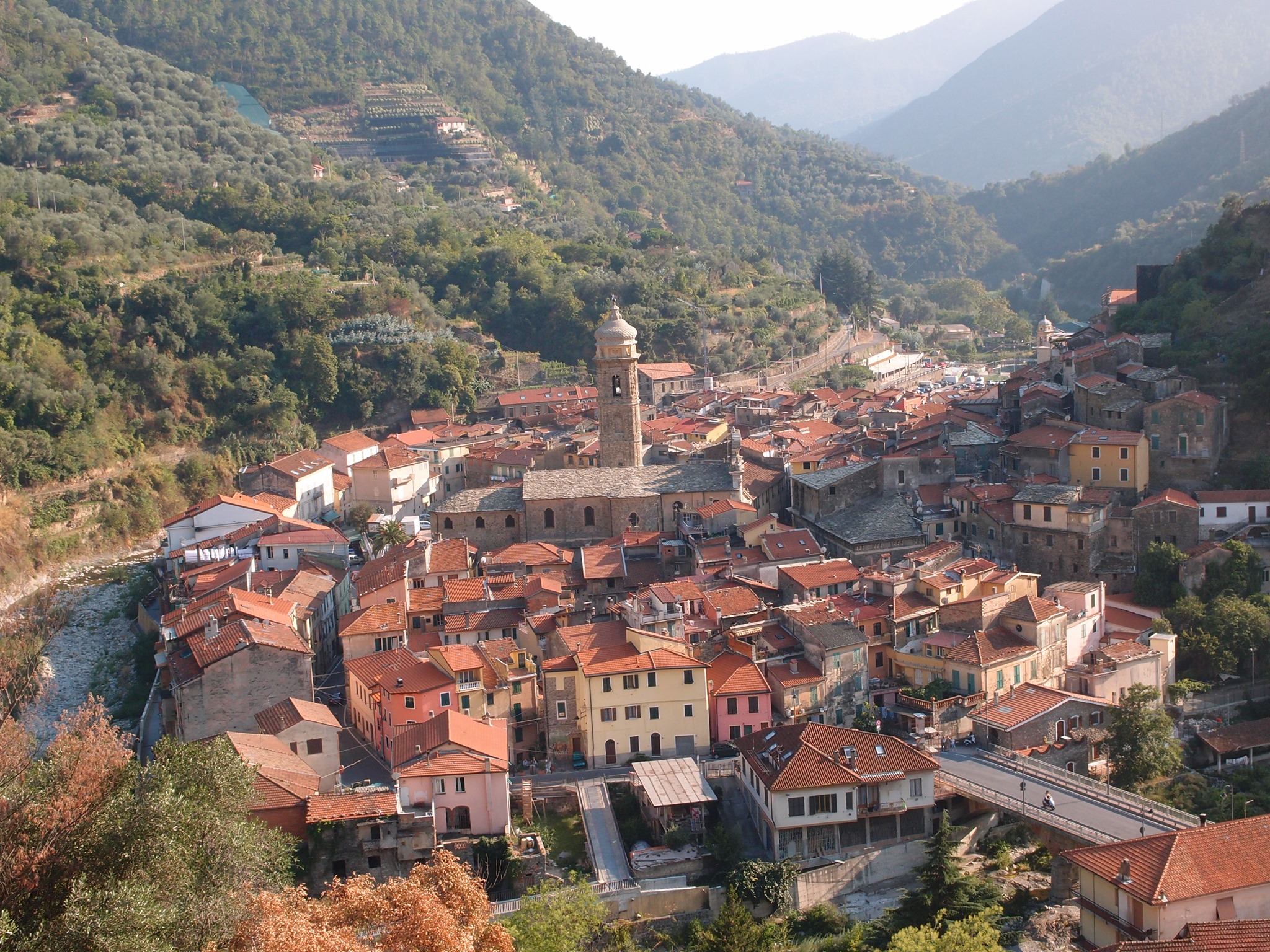
Here we see the moment of the passage between the coastal dimension and the one that goes towards the mountain: in Badalucco the meeting of water and stone is celebrated, with aerial and powerful bridges. Badalucco, a painted village, is an open-air museum of ceramics and murals, which blossoms from street to square, inviting visitors to discover.
Institutional website: http://www.comune.badalucco.im.it
BAJARDO
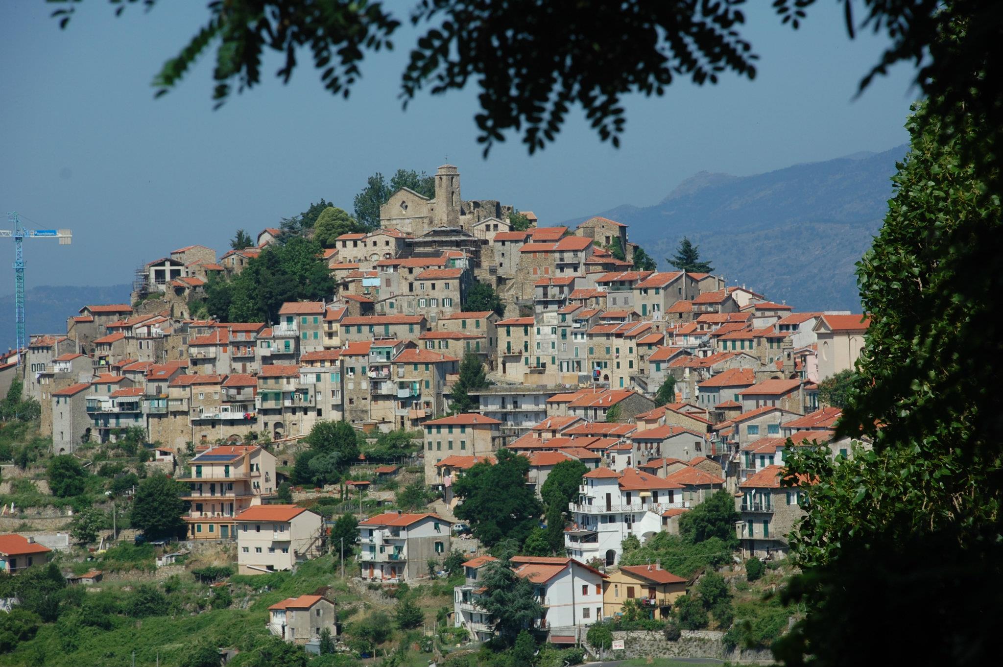
Bajardo is a town that has 340 inhabitants and is located at an altitude of 910 meters, the highest municipality in the province of Imperia. Mountain village of the Armea valley located, as the crow flies, 10 km from Sanremo and positioned on one of the mountain ridges of the Maritime Alps in the hinterland at the apex of the Nervia valley. The territory of the municipality lies between 332 and 1627 meters above sea level. The territory is mainly composed of olive groves, mountain Taggiasca quality, by now uncultivated arable land, vineyards, chestnut groves and mixed woods. Today part of the uncultivated land has been used for floriculture. The village has a typically rural character, with both linear and annular structure, and has many environmental and architectural aspects typical of Ligurian villages: stone, narrow alleys, with tall houses connected to each other by counterthrust arches.
Institutional website: http://www.comunebajardo.it
CERIANA
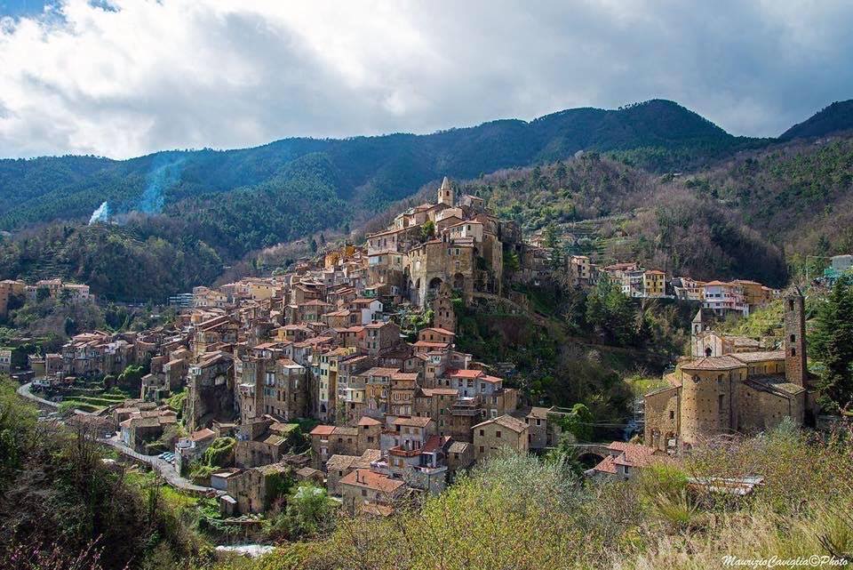
Ceriana, just over 1000 inhabitants, located in the Armea Valley in the hinterland of Sanremo, is a perched, hanging village in which the houses push each other around the bulk of a parish church. The character of the Cerianaschi is full of passion for their ancient city, for their traditions and for the values in which everyone recognizes themselves: in Ceriana Liguria shows one of its most genuine sides. Ceriana is a real monument town.
Corporate website: https://www.comune.ceriana.im.it/
SOURCES: Institutional websites of the Municipalities, Wikipedia, RivieraLigure.it